Final Two Apps
For the app based on Chapters 1-4 I created a survey that took a look at the various right of way points in neighborhoods in Delaware. I think this survey could be used to see which areas in Delaware require thing put in place to make a right of way stop easier to navigate such as better crosswalk line visibility.
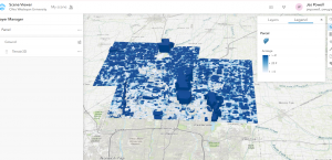
For the app based on Chapters 5-7 I created a simple web scene of the various acres of land in Delaware using the Parcel data from the Delaware Data. This 3D map just shows which parcels have a bigger acreage.