Hello, my name is Gabrielle Plunkett and I am a senior majoring in Zoology. I’m from Cincinnati, Ohio and I have an orange cat named Finn. I took GIS 291 at the start of last semester so I may be a little rusty in the beginning, but I am excited to expand my GIS knowledge.
In 291 I believe I poked around the website a bit, but I don’t think I used it to its full potential. I remember having to upload something from it and it took a while to load. When looking at my profiles I can see I created web maps and feature layers. I looked around the gallery and thought it was interesting to see what data has been collected and maps that were made. The training section also looks like it’ll be good to use if I get stuck.
The introduction to ArcGIS was interesting and a good overview. I think one of the more interesting parts of the introduction was the “be mobile in the field’. Being able to create maps offline and also have the ability to sync them to the latest update has to be extremely helpful for fieldwork. Also being able to access it through a mobile app is cool.
The basics will definitely help me at the start of this course. I will have to look back and remember the difference between the layers.
Search One:
My first search was “ArcOnline Plants”. I found a study using geospatial cloud computing to monitor the phenology of plants. This map in particular is a heat map that shows aggregated March, April, and May 2014 plant data. This type of map could be used to monitor flowering patterns during unusual fluctuations in temperature.
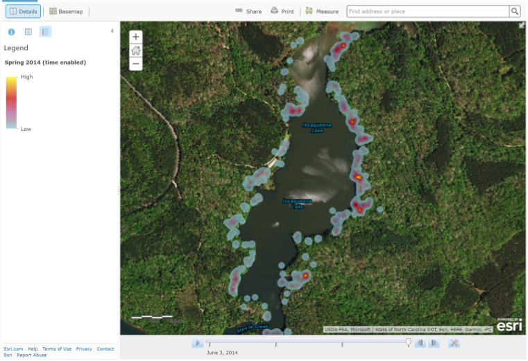
https://www.sciencedirect.com/science/article/pii/S1574954116301078#ab0005
Search Two:
My second search was “ArcOnline Crows”. I have always liked crows so I decided to search and see what would pop up. I found this map for possible American crow viewing points in California. This map would be helpful if someone was out birding or wanted to research crows and needed to find locations they could be at.
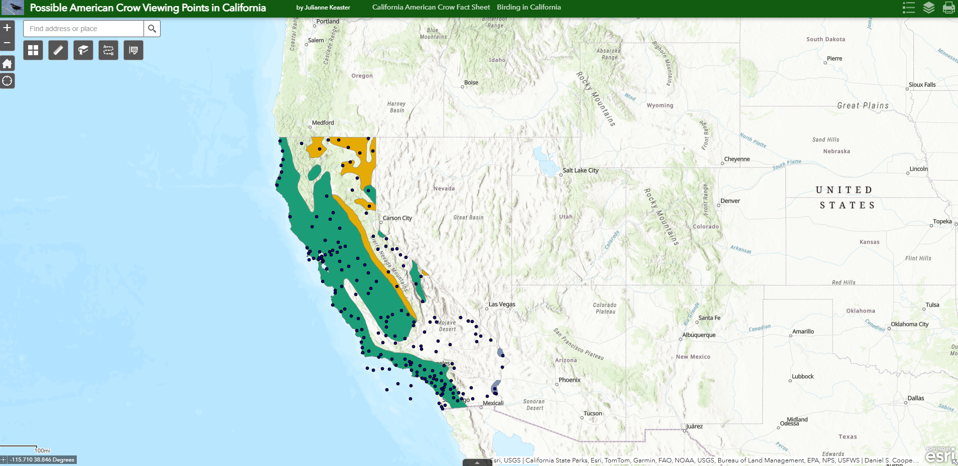
https://www.arcgis.com/apps/webappviewer/index.html?id=8ec23699138c46a08660108f2f44699f