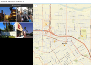
Chapter 1: There are a lot of reasons to be using webGIS for more major projects that are meant to be publicized. Some of the reasons they have listed are: Global reach, large number of users, low costs per users, better cross-platform capabilities, ease of usage, and easy to maintain. Some of the main organizations or reasons to use it, and reasons why I may use it in the future are for Business and Governmental use, however I was interested to see that people use Web GIS for their daily life. A majority of the stuff brought here seem fairly basic, yet good information to keep in mind while working on maps. Such as the dominance that phones currently hold in the information technology world for the average person. It also reminds us on how some of the different types of data interact. The first tutorial was more about how to upload data into webgis & share it. The second tutorial was more about how to add a field and add some data through the web page. The third tutorial was about how to add the feature layer into a proper web map. I had not been able to find the community map, so I decided to just use the streets map. It was pretty cool to make a functioning webpage for a map.

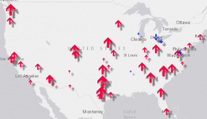
Chapter 2: This chapter overall is a little more ‘intense’ than the previous one. There is a lot of focus/emphasis on the creation of feature layers and the techniques of doing these feature layers. Tutorial 1 had a good review on how to implement data & how to change a few of the fields’ names. Tutorial 2 had more symbiology work, in this case it was a comparison between the population of 10 years prior and to a set date. Tutorial three was pretty cool by having me create an expression and using the data to appear on my pop-ups, I know that I will need more practice doing this to fully remember it. Tutorial four was about how to add various types of media in the popups window, particularly links, images, and charts using the data that is saved in the csv. The fifth tutorial I got stuck on towards the end as I was a little confused on how the map actions worked, however the rest was fairly intuitive as it was setting up a storymap. I think these will be pretty interesting to utilize, especially for things like the trip project that I will likely be doing. Tutorial 6 was more about how to add a swipe block to use map activities. I will likely want to use this for if I were to make a story map to say ‘hey, we will be going here, here and here’, which may be a great strategy for the vacation idea.
D escription of an application of WebGIS using my data or that from Geog 291:
- Landmarks around my city. I can find a bunch of important buildings and take pictures of them from my city. As my hometown is so small, I will likely be able to find or take pictures over a weekend. I will then attach it all to a single map and make an app out of it. (Ch 1)