Hi! I’m Ethan McNichols, I’m a senior Environmental Studies major and a double minor in Data & Society and Social Justice. I play Dungeons & Dragons, I’ve operated a discord server to centralize folks who play on campus so they can find games and other players. Its been in various conditions of activity and functionality over my four years here, currently working on cleaning that up so it can be handed off to an underclassman when I graduate because I think having that infrastructure is important. I also play Magic: the Gathering, which just recently got an official club! I’m the treasurer for that now. I’m learning HTML on my own time to potentially end up making my own website/blog since I’m getting pretty fed up with the direction large social media sites are moving. I’ve also been listening to Ginger Root’s new album Shinbangumi a lot, I highly recommend it!
I’m going to try and stay ahead of my work in 292, it wasn’t awful to get caught up in 291 but it’ll be better to not have to deal with that at all on the latter half of the semester. (Written 10/16 lol. Didn’t finish this post before I was on a 3 day trip for Cross Country. *now* I’m going to try and stay ahead of my work).
I confirmed my new GIS account. With a budget of 1000 credits that I found in my settings I’m curious what all we’re gonna do. Just from reading the “getting started” section the notably different features seem to include a favorite system and a comments/rating system, as well as integration with social media sites to be able to share things. Floor-aware maps seem like an interesting function but I don’t know how much we’re going to be working with interior spacial details.
The training button seems to be broken. Everything below that seems to as well. They all open a new tab which fails to load. I ran into this last week and it seems to still be an issue a week later, on a different computer. I’ll send an email to Krygier about it.
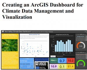
For the google scholar stuff I looked up “Ohio climate” because I’m interested in how this is being used for local climate change. Turns out there’s a 2022 senior thesis from Wooster about how up to that point there was not a centralized place for this data, so they’ve been working to update some of Wooster’s server infrastructure to serve as the beginnings of a centralized ArcGIS dashboard for managing and visualizing local climate data.

Edit:

It loaded, I did the training. This page is also stalling out on me. Its late so I’m not waiting for the certificate to load.