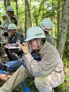
My name is Ellie Dodds. I am a senior environmental science major and history minor. I took GIS 291 two years ago (back when it was 191!) but I am excited to take the second part. I love envs but I am more of a hands on field work kind of person but I like the idea of being able to use GIS to better do field work. Here is me in Japan looking at soil!
While poking around on the website I noticed training courses that deal with coding and that peaked my interest! I did some coding in high school but haven’t been able to apply it here at OWU. I am most interested in the Python courses but Java and JavaScript are what I worked with before. The community forums also looked helpful for later on in this course. I found the scene viewer page on the Get Started: What Is ArcGIS Online to be a nifty cheat sheet on the different icons. I noticed an elevation tool which looks cool because I love topographic maps. I definitely intend to work that into my gis this semester if possible. I found the clickable links to be helpful for navigating this much information.
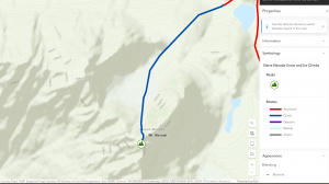
The training was easy to follow and I didn’t run into any hiccups. I found this to be much easier than the desktop version. I loved working with the scenes, I didn’t realize that it would be in this course. It had super specific instructions.
Online I found many applications relating to birds. I found someone working on an online bald eagle location map based on crowdsourced data. 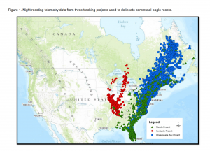
Lukei Jr, Reese. “CREATION OF A NATIONAL REGISTRY FOR BALD EAGLE COMMUNAL ROOSTS.”
I also found one that used museum collections and arconline to map about bees.
Day, Baylie Lenora. “Thematic Mapping of Apidae Holdings Within the University of Arkansas Arthropod Museum.” (2024).