Hi, my name is Auzlynd, I am a junior majoring in environmental science and biology.
I already have an OWU ArcGIS Online account from taking the Geog 291 course earlier this semester.
In the My Profile section, the projects I did in 291 are saved there. The training section shows courses you can take to gain skills in web mapping and analysis and The ArcGIS blog section shows what is new in ArcGIS Online with various other articles.
From the reading “Get Started: What is ArcGIS Online” I learned that ArcGIS is a cloud-based mapping and analysis software with many uses like making maps and analyzing data. It also serves as a facilitator for sharing and collaborating. You can create maps, scenes, apps, and notebooks and manage the data you explore and analyze. This software can be used in field activities as well as configuring sites and provides tools for accessibility.
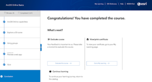
The course “ArcGIS Online Basics” helped give me a solid foundational understanding of all the features of ArcOnline. I have attached some screenshots.
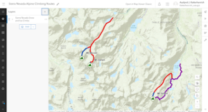
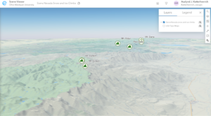
Using ChatGPT I looked up how hiking or camping could be applied in GIS. I learned that GIS can be used to make maps of trails used for hiking and these include useful information like difficulty, trail length, elevation gain, and points of interest. This is helpful so that hikers and backpackers can plan hikes and navigate trails. Here is a source I found that I thought was interesting: “Planning of recreational trails in protected areas: Application of regression tree analysis and geographic information systems” (Aleksandra M. Tomczyka, Marek Ewertowskia)