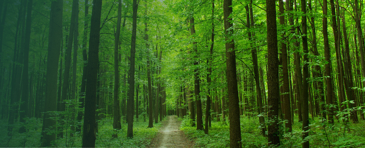
Today our group put together several maps in GIS to highlight the work we have done this semester on the Delaware Run Project. These Images show all the trees we were able to map, soil types, and projected Delaware Run pathway.
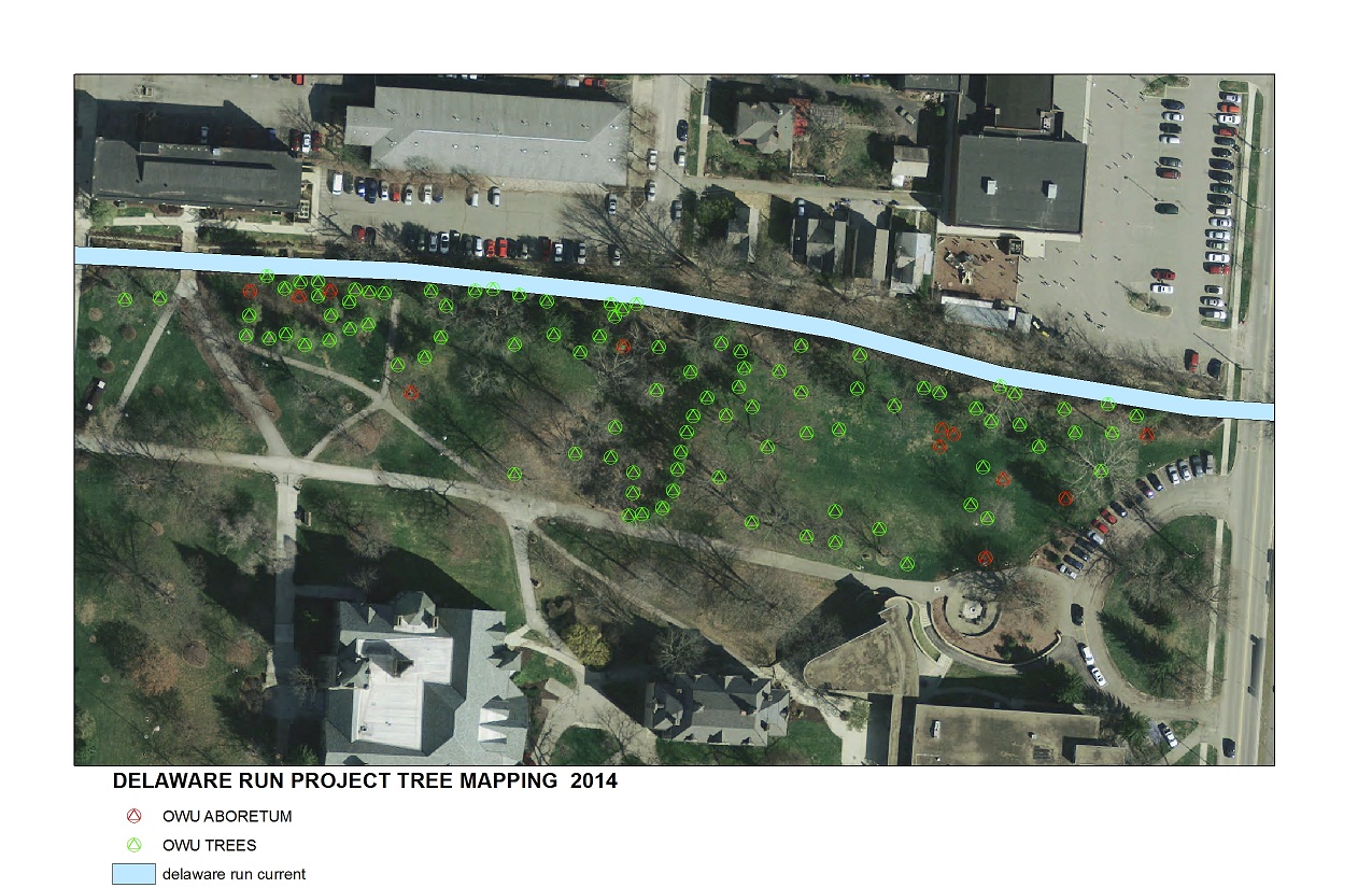

Today our group put together several maps in GIS to highlight the work we have done this semester on the Delaware Run Project. These Images show all the trees we were able to map, soil types, and projected Delaware Run pathway.
Posted in Research - Student
To tree or not to tree? That is the question.
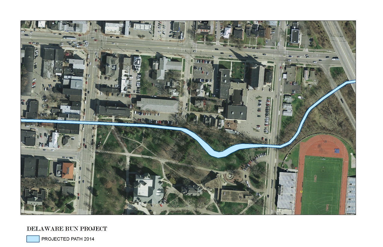
MAP C
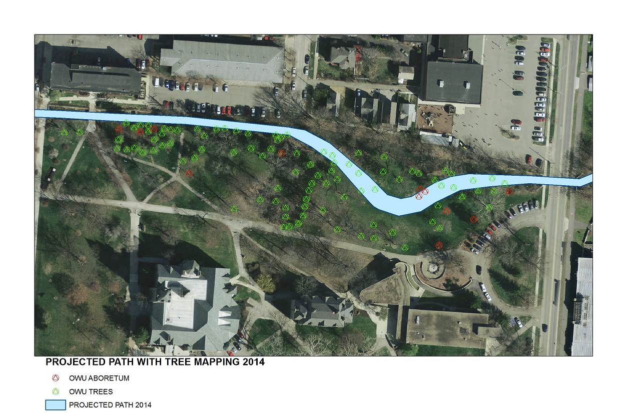
MAP B
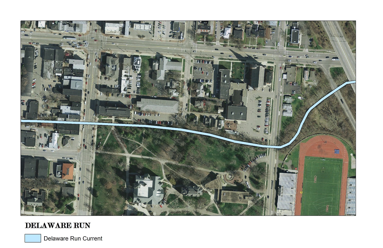
MAP A
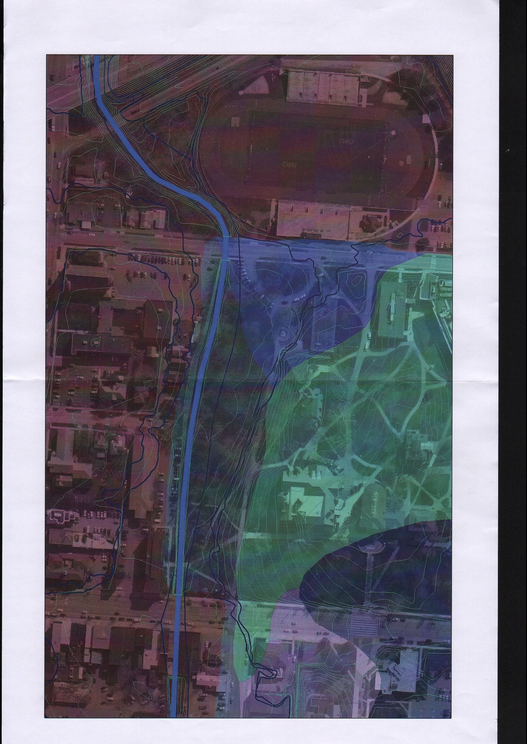
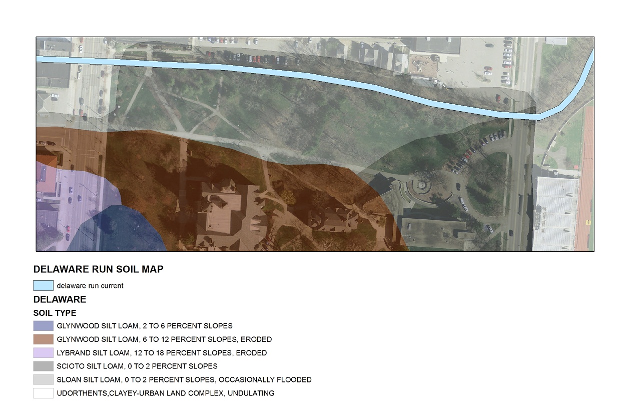
SOIL MAP
Posted in Research - Student

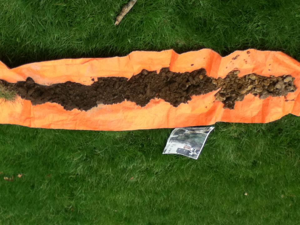
We broke up into groups today to try and accomplish more work. We should have all the information on the trees along with the soil samples entered into GIS today. Half of our team is working on the final soil sample, to confirm our findings and hopefully to prove that we did not encounter fill for the old football field. We have decided that we will try and project the stream path this Wednesday and then use the remainder of this semester to clean up the blog and try and project the next steps for the students coming and and continuing on this project next semester.
We are feeling pretty good and think we have gathered quite a bit of information for the semesters to come.
Posted in Research - Student

Today as a group we were able to finish up the Tree Locations. It was as exciting as 1970’s hair styles.
Posted in Research - Student
Today we have broken into groups again. Torrential downpours have left us struggling to get data, we have finished entering all the data we have collected and some of our more adventurous members have gone out in the rain to do soil samples. Others are updating blogs.

Pic: Ali Getting Stuff Done!!
Posted in Research - Student
We as a group have continued to map out all the trees next to the Delaware Run and entered data into GIS. We felt like it would be more productive to start breaking into groups to try and achieve more work this week. We shortly met with Professor Krygier to discuss getting the soil samples, we will be getting information on how to do this by Monday. Trees, trees, and more trees.
Posted in Research - Student
As a group we met with Professor Krygier to discuss the “Delaware run project in further detail. During this discussion we decided that the two most valuable layers we could add to this project would be the soil layer to make sure it was more accurate and tree data next to the run. We mapped out the soil content on the 24th and have decided that later we will want to take some soil sample to make sure our mapping in GIS is accurate. March 26th we printed off maps and sat down as a group to decide which attributes would be most important to enter into the tree layer. We also used the end of class to start getting tree data.
This is all we see:
Posted in Research - Student
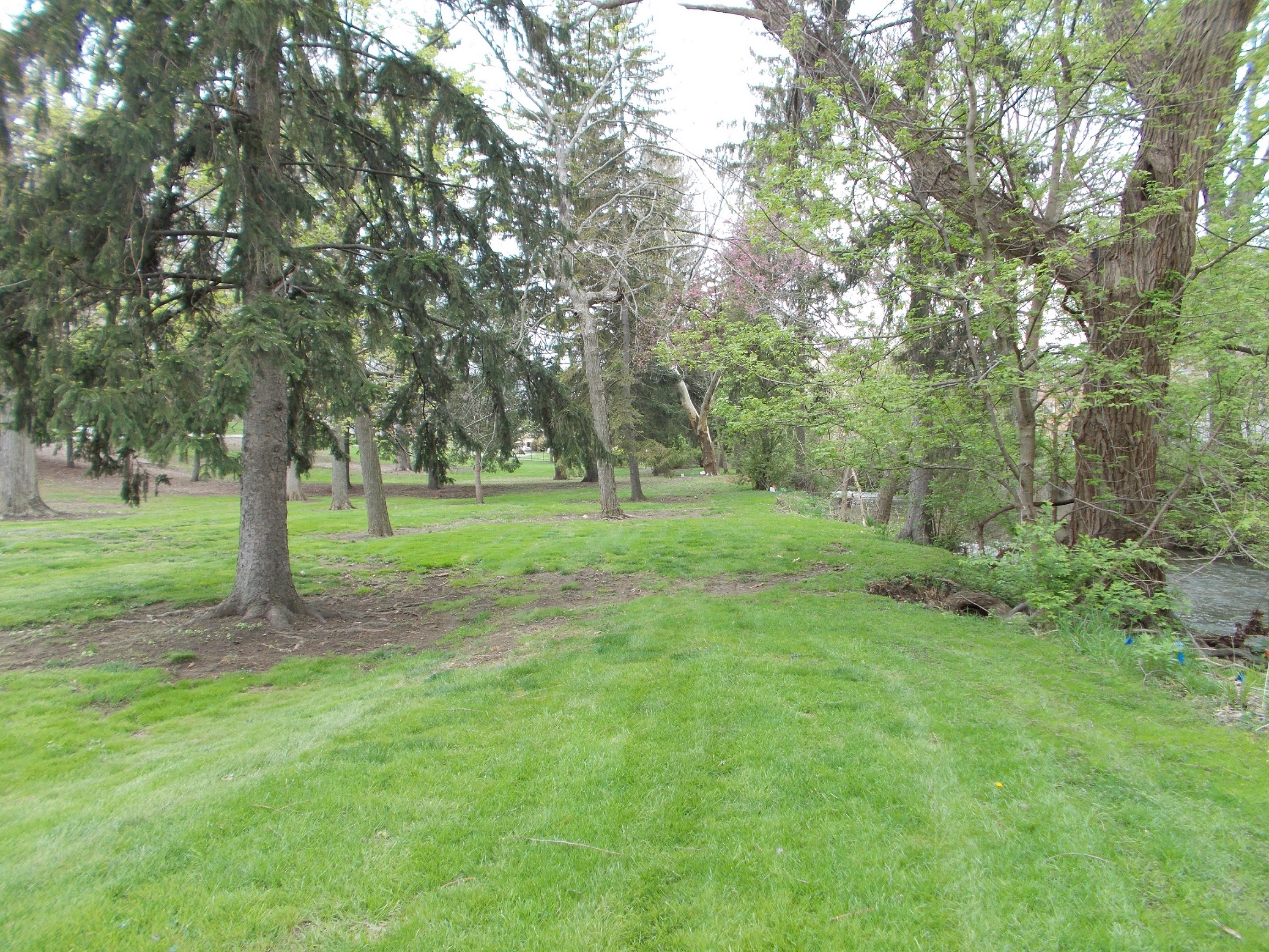
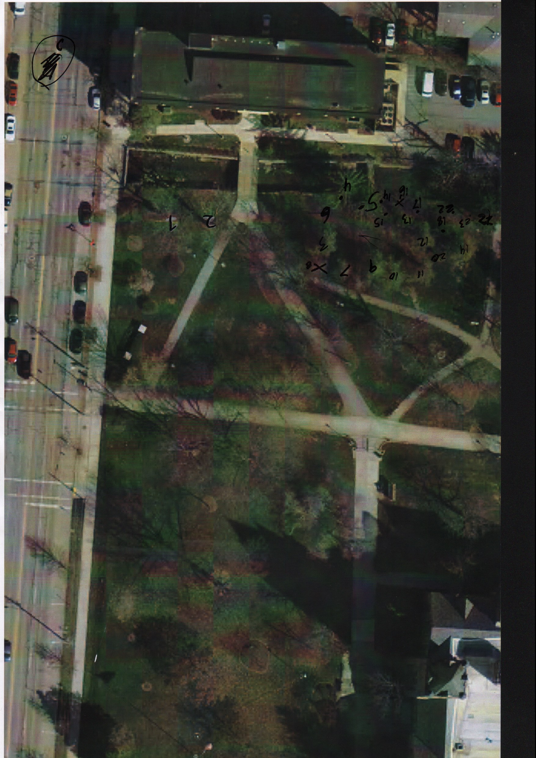
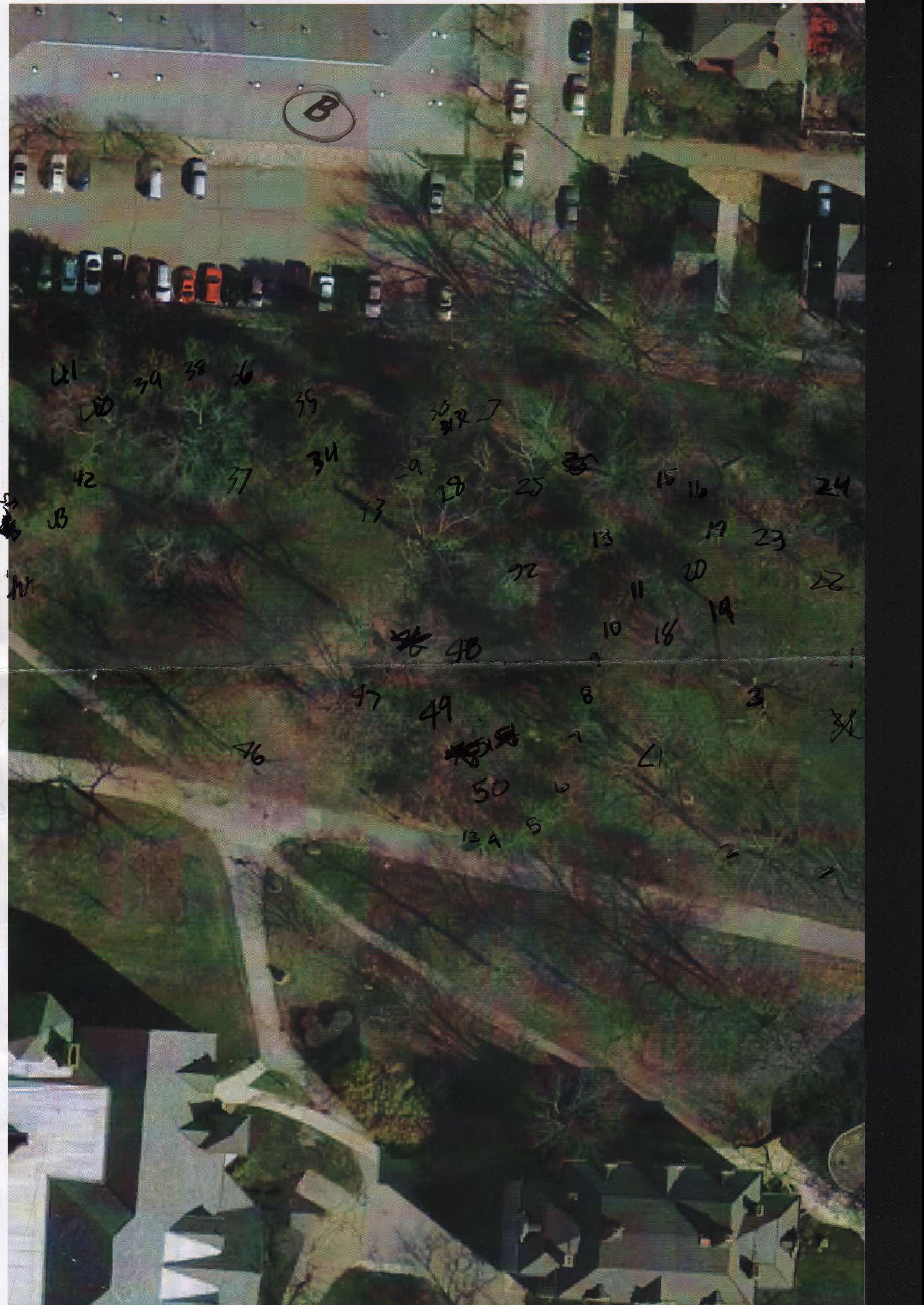
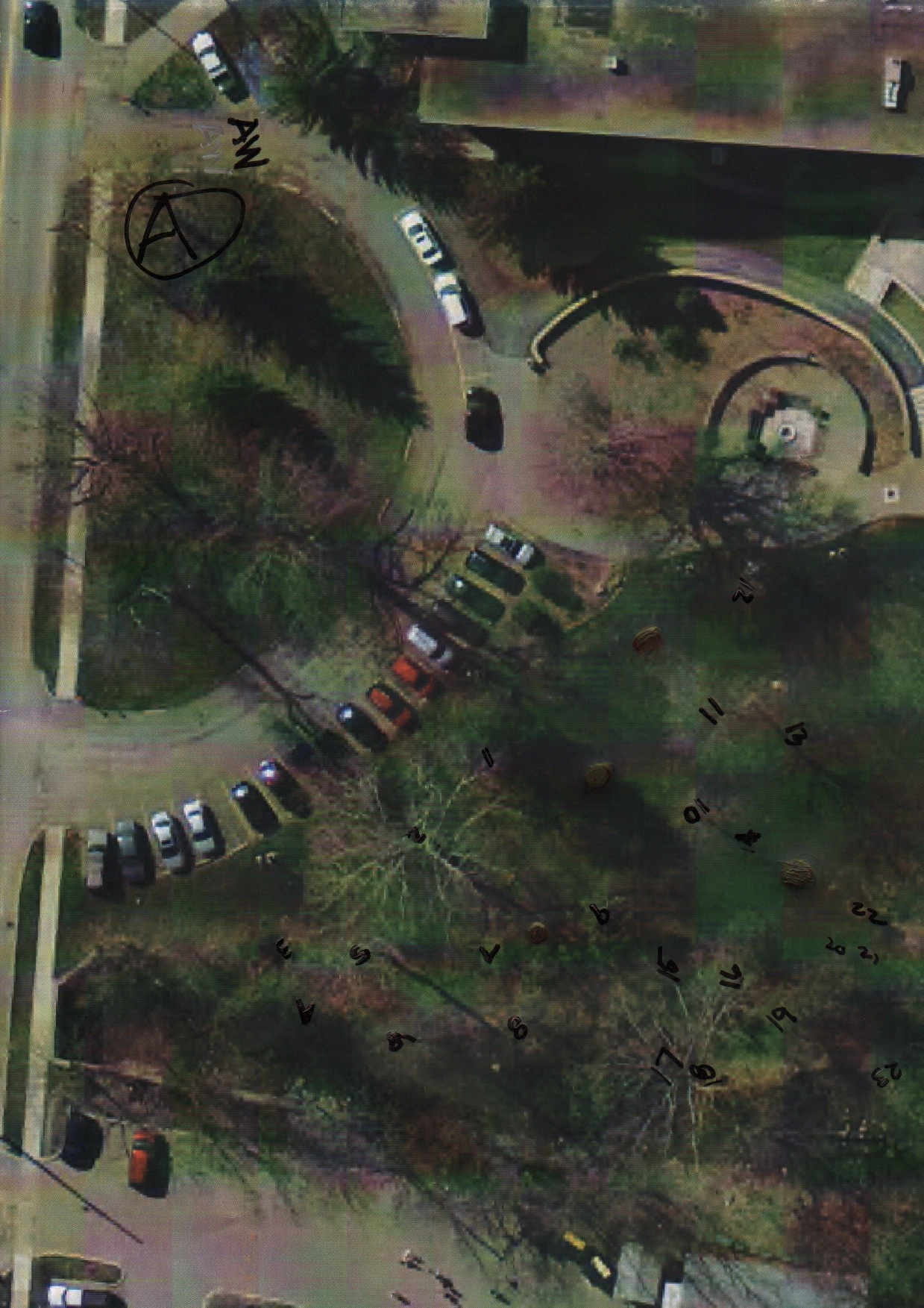
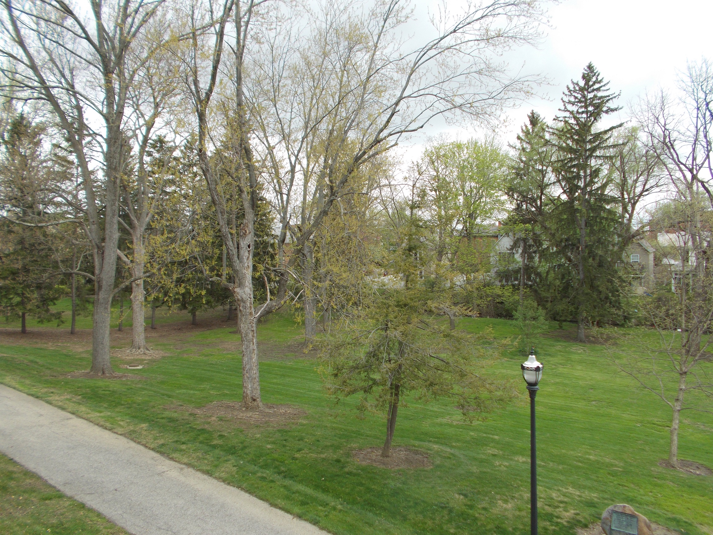
The past week and a half we have been mapping out the location of each tree on the floodplain including various estimates on; the circumference and height of the trees, whether they are native species or not, if they are included in the arboretum and the tree type. We used the pencil method to find the estimated height and measured the circumference with a measuring tap from the geology department.
This data has never been collected before and will be very important as we try to predict a path for the delaware run. We are currently placing our data in arcGIS in order to create a map with our individual attributes.
Posted in Research - Student
Issues that we are going to have to deal with.
The route of the run
How it will affect the trees
How much we will be able to change the path (How much will the contractor do)
Is there anything we have to work around for the path( utilities etc..)
Coordination of different groups
Who is involved with this project (Names and contact information)
Do we all have the same view on the project (on the same page)
Posted in Research - Student
Research on Stormwater Credits:
Delaware:
http://www.delawareohio.net/UserUploads/UserDocuments/
Departments/Public_Utilities/StormCreditManual.pdf
Ohio:
http://www.neorsd.org/I_Library.php?a=download_file&LIBRARY_RECORD_ID=4699
Storm drain decals in delaware run? – on drains above the bridge
Floodplain zones:
1. 0.2 PCT annual chance flood hazards (special flood hazard areas)
2. A: area subject to a 1% or greater annual chance of flooding any given year, with no flood elevation shown
3. AE: area subject to a 1% or greater annual chance of flooding any given year, with extensive hydraulic analysis that shows the flood elevations
4. X: areas of limited flood hazard (outside 0.2% annual chance floodplain)
Information on soil type: In order to prove we cannot build buildings on this floodplain it is important to look at what soil types exist in order to prove it is a wetland.
Sloan silt loam, 0 to 2% slopes, occasionally flooded: Very deep and poorly drained soils formed in loamy loose unconsolidated sediment. Sloan soils are most commonly on flood plains and are very poorly drained due to low permeability.Known to be artificially drained and cultivated but also known to be used as pastures or woodlands.
silt (size measurement between sand and clay whose mineral composition is quartz and feldspar. May be a soil or a suspended sediment). loam (soil composed mostly of sand and silt, with a little clay).
Scioto silt loam, 0 to 2 % slopes: contains very deep poorly drained soils and are subjected to flooding from late fall to spring. Known to be artificially drained and cultivated but also known to be used as pastures or woodlands.
Sources:
Posted in Research - Student
