
Fall 2013 Project PDF: Delaware Run Restoration Preliminary Research and Analysis
Streams to Dreams: Delaware Run Project, Spring 2014
Smith, Kerns, Siefker, Taylor | GIS 355 | May 2, 2014
Friday May 2nd 2014
During the spring semester 2014 the “Streams to Dreams” team decided the importance of building on the research gathered from the previous semester (link to final report, below). To keep continuity we wanted to see this project evolve in a way where each semester was able to provide their fingerprint. This would allow for the project to continuously move forward and gain momentum as additional classes grappled with adding their perspectives and information to the project.
Spring 2014 Project PDF: Streams to Dreams: Delaware Run Project
As we began to study the information from Fall 2013 we developed our own direction for additional work on the Delaware Run project:
Our Project goals:
- Get more information on the storm water credits.
- Get additional terminology to better help understand floodplain areas.
- Work on soil sample information in arc GIS, try to get a better feel for the flood plain area.
- Map out all the trees next to the Delaware Run.
- Start getting an idea of soil types in the area to predict flood plain.
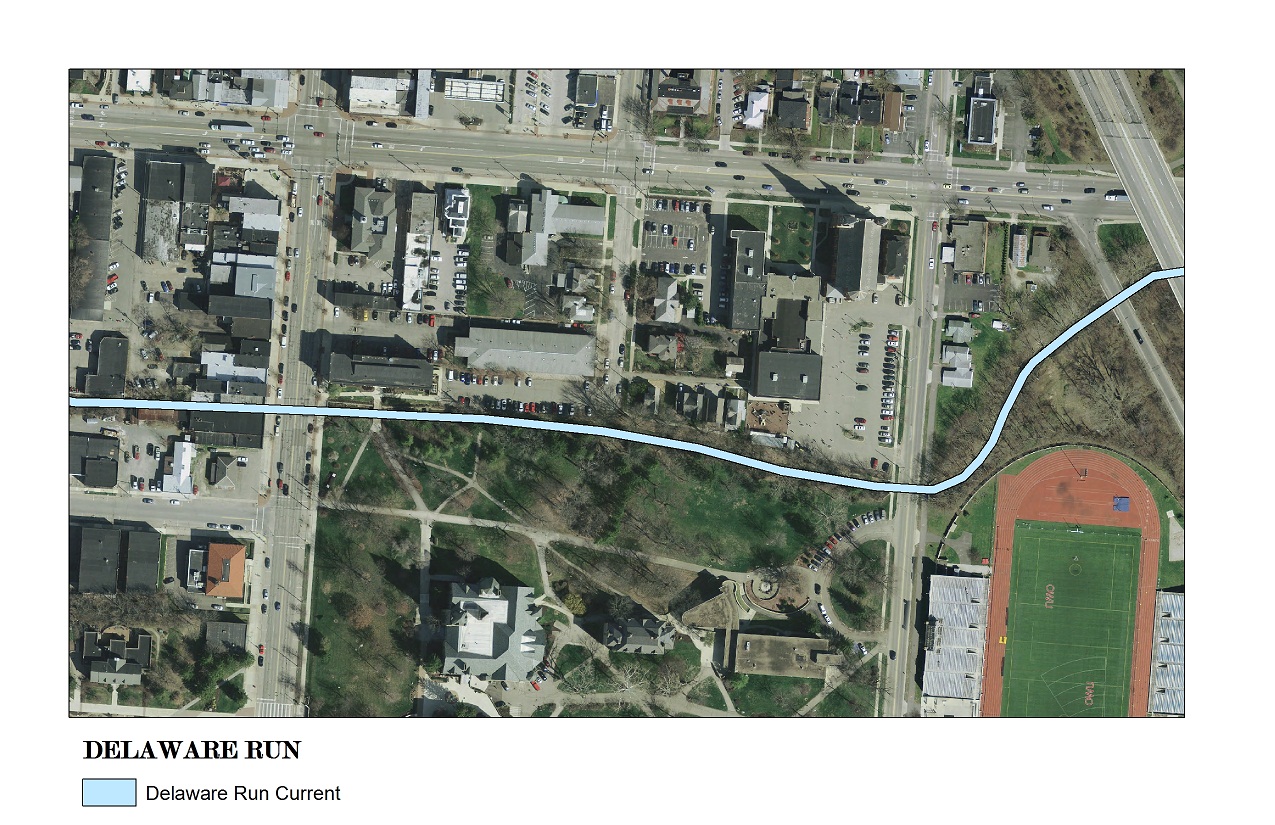
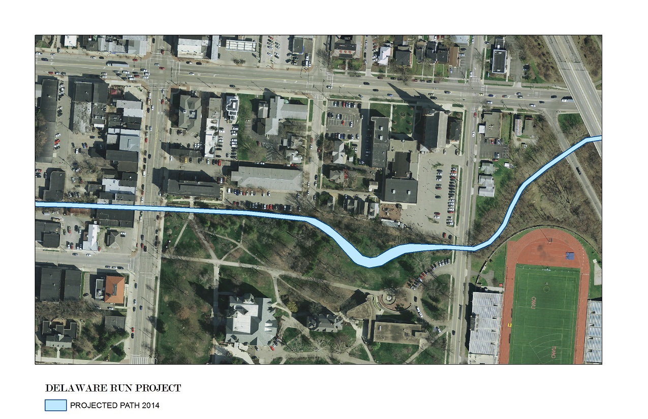
- Gather as much information to project the new path of the Delaware Run.
- Provide as much information for future.
- Provide suggestions for future classes to keep continuity.
- Provide all data information for future classes to build upon.
Additional research and analysis:
Soil Terminology:
https://soilseries.sc.egov.usda.gov/OSD_Docs/S/SLOAN.html
https://soilseries.sc.egov.usda.gov/OSD_Docs/S/SLOAN.html
Storm Water Credits:
Ohio: Storm Water Credits
Delaware, Ohio: Storm Water Credits
Procedure:
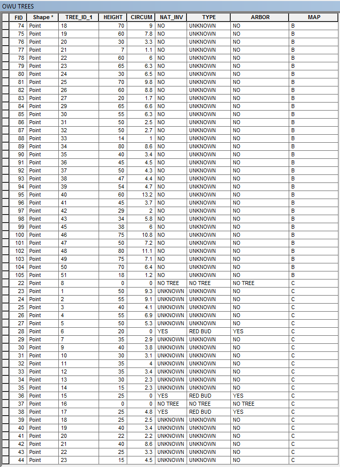
We will map out in AcrGIS the points of all of the trees in the affected area along with some soil samples.
What we are going to do for the tree data:
- Have a printout map of the area of research from the ArcGIS Orthophoto from the Delaware data
- Mark on the map the points of the trees
- Number the trees and collect data
- The data we collected from the trees was
- Circumference
- Estimated Height
- Native or invasive
- Type of tree
- If it’s a part of the OWU Arboretum
- If we are not sure on some of the information like the type of tree and if it was native or invasive we will label it unknown in the attributes table.What we are going to do for the soil sample data:
- We located on the soil maps from the Delaware data in ArcGIS two different soil types.
- We are going to try and see if we can tell the difference between the two soils types.
- Also we are going to see if there was construction fill put in to make the Run straight.
- We are also going to see how far down we must dig until we hit stone or water in the sediment.
- What we are going to do with the collected data
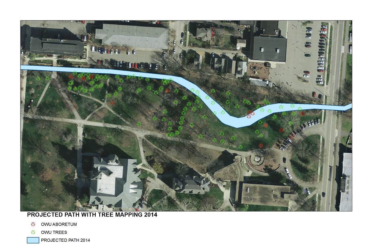
- With this data we are going to project a path for the run, closer to its original meander.
- We are going to avoid arboretum trees.
Results:
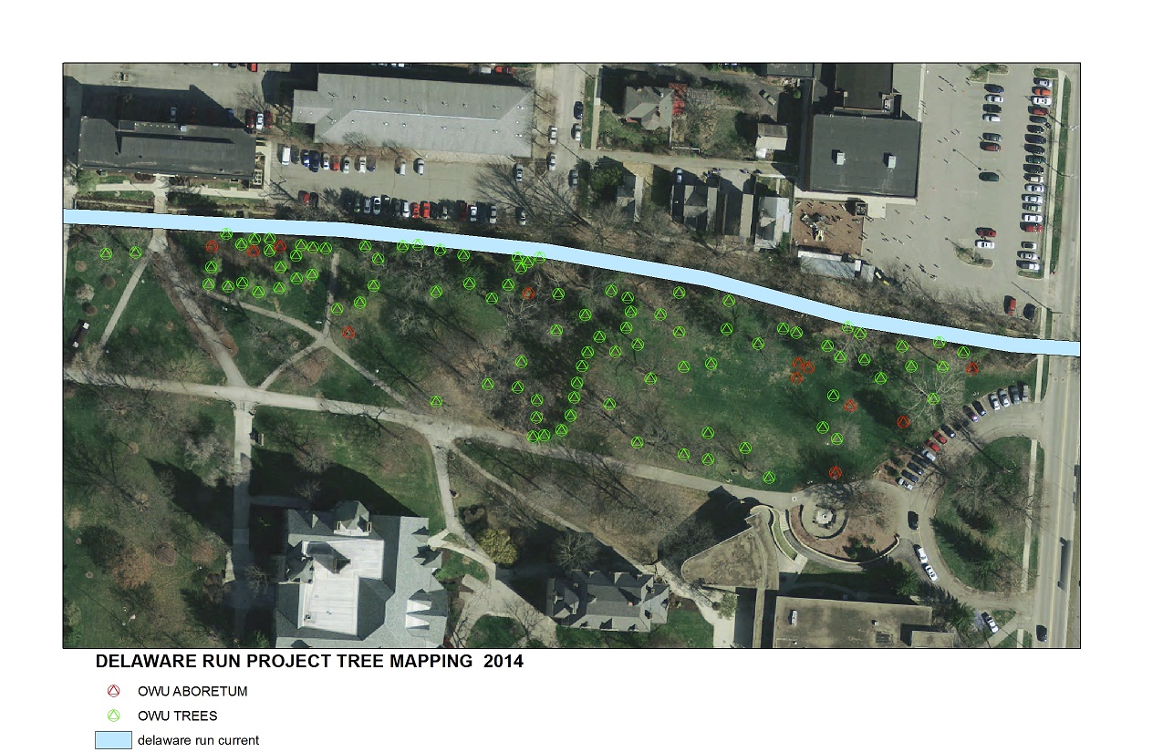
- After collecting field data for all of the trees in the flood plain of the Delaware run, we placed the information into ArcGIS. The data was sorted by 3 different maps; A, B and C. The only trees we could identify were in the OWU arboretum but as a short term goal for future participates we would like to identify all trees within the area.
- With this data and the projected path we think that we are laying a great foundation for the research and projection that needs to be done before this project can break ground.
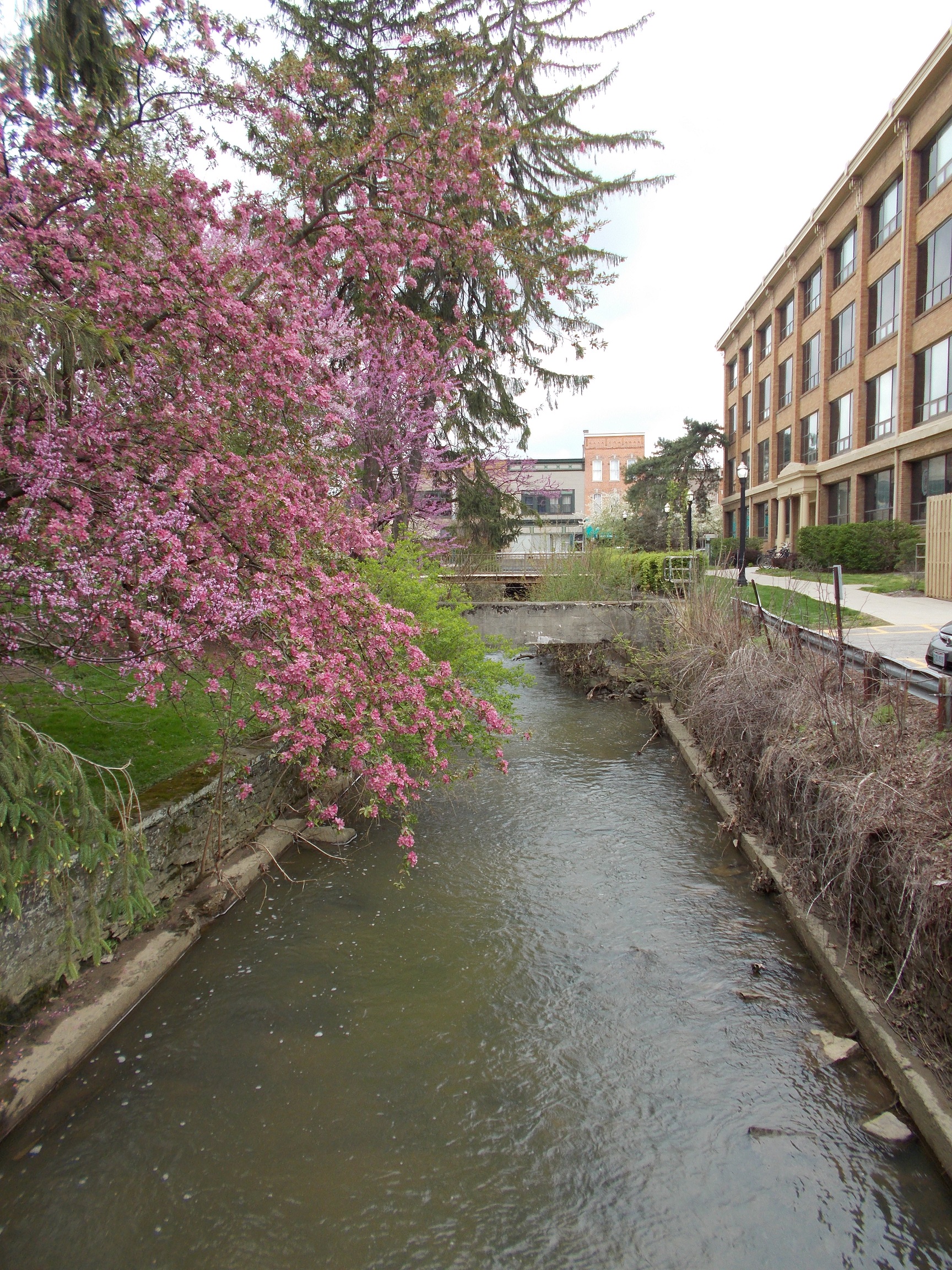
After collecting soil samples in five different locations, we were unable to tell if there was fill from the previous football field. We were able to clarify that this area is indeed a wetland and that our projected path will be inside the floodplain.
Our projection of the flood plain involves us moving three small arboretum trees to a different location on the floodplain. Because they are small they will transfer more easily then the larger arboretum tree on the cut bank of the projected path.
By mapping out all of the trees within the floodplain we were able to project a path that would involve the least destruction of natural habitat. The meander we added to the Delaware run emulates its original path in order to start the processes of de-channelization.
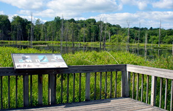
Maps:
Goals for Buildings and Grounds: (Excerpt from Peter Schantz E-Mail)
Delaware run maintenance issues to be considered during a renovation project
March 10, 2014
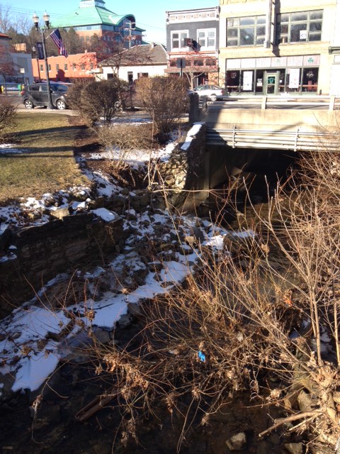
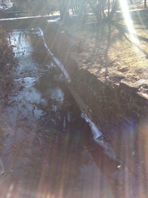
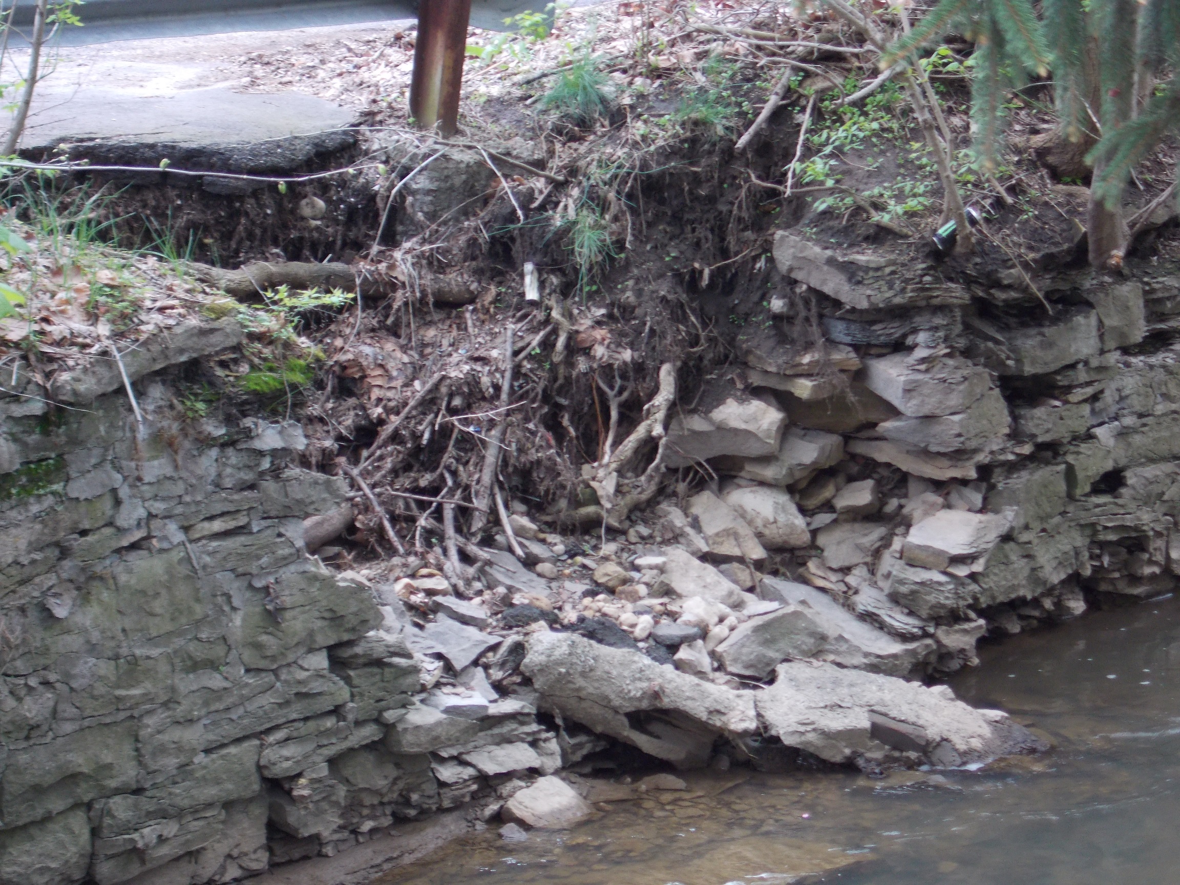
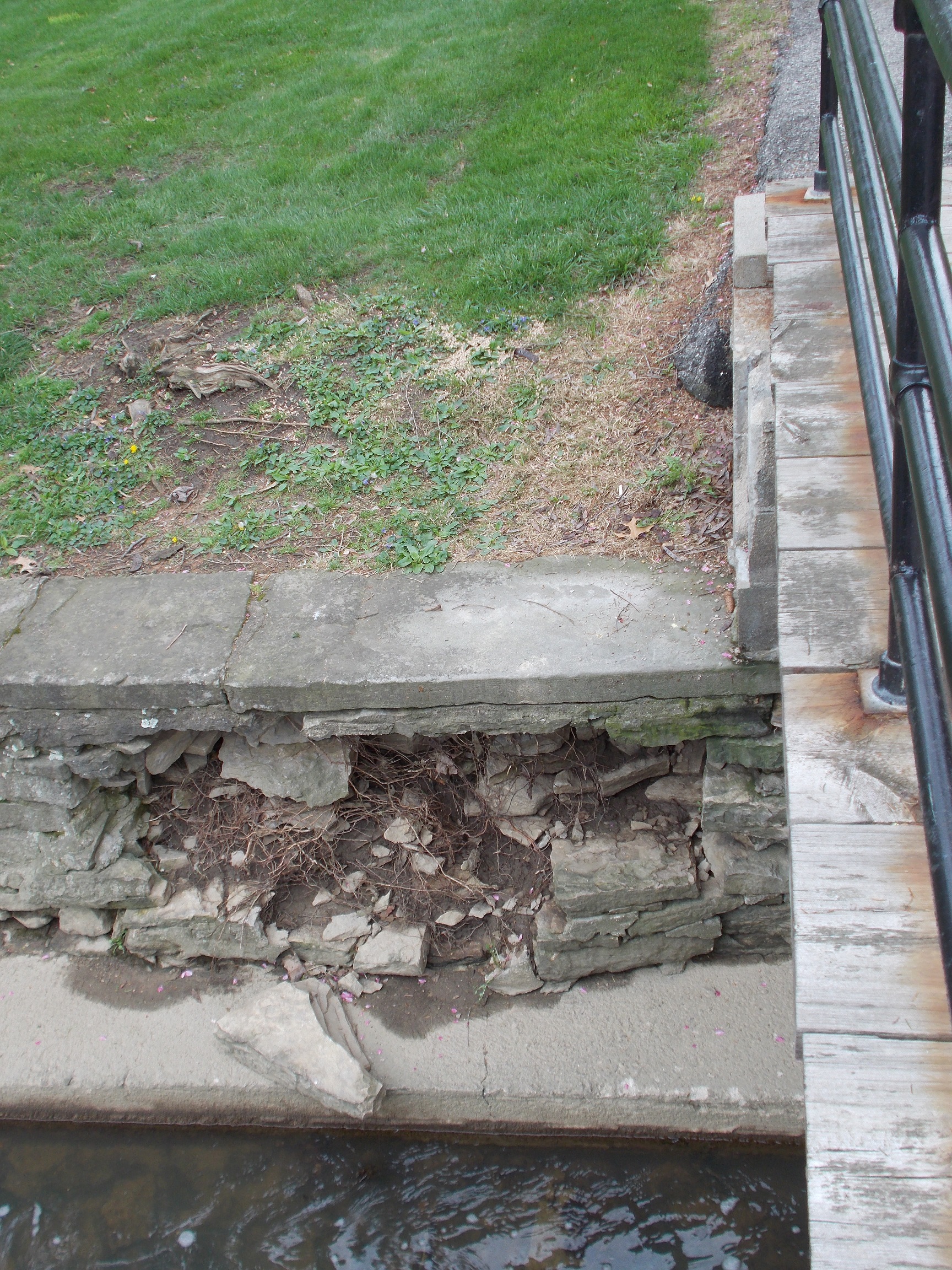
- Fix wall on south bank at Sandusky Street bridge
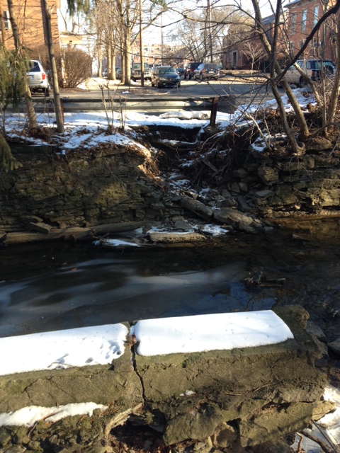
- Fix wash out east of bridge support
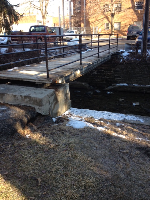
- Re-engineer bridge at Edgar (span will likely increase and support and landing reworked)
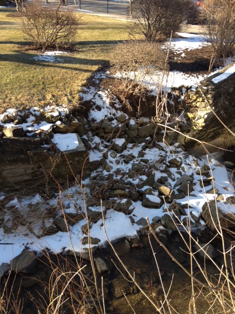
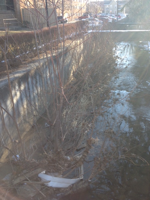
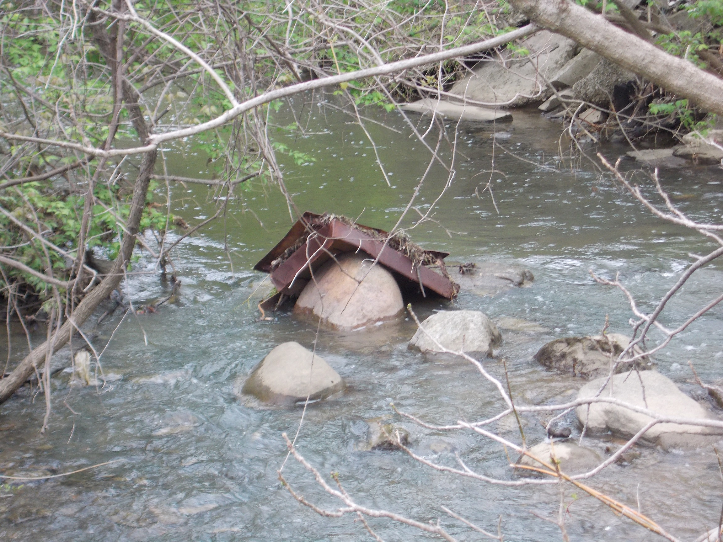
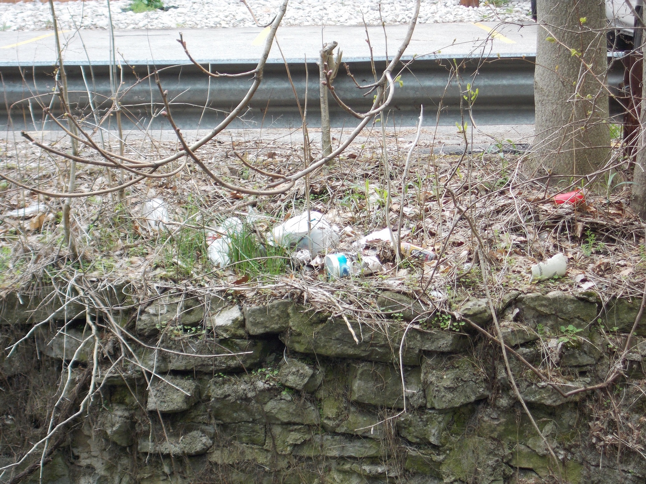
- Clean out accumulated plant material and trash
- Repair or remove leaning south wall of run between 2 pedestrian bridges
- Identify if data or other infrastructure still runs through concrete raceway between bridges
- Re-engineer bridge east of Edgar (span will likely increase and support and landing reworked)
- Repair cave in of North side wall east of eastern most pedestrian bridge
- Install maintainable banks where retaining walls are to be removed
Short Term Goals:
River Clean Up (Still Not Complete, See 2013 fingerprint)
Ecological Studies (Still Not Complete, See 2013 fingerprint)
Buildings and Grounds wall restoration and removal:
Tree Identification:
2014 we mapped the trees next to the run, still need to determine tree types. Nancy Murray and David Johnson sent us information and will be able to help further identify these tree species.
Contacts: namurray@owu.edu, dmjohnso@owu.edu
Data: Plants of the Jane Decker Arboretum Ohio Wesleyan University (PDF)
Soil Samples:
We were able to begin the process of soil samples but our testing was mostly inconclusive. We were trying to determine if there was fill put down to level this area for the OWU practice field. We suggest further analysis to determine whether this was in fact leveled, by doing more soil samples.
Long Term Goals:
Time and resources allowing, the Delaware Run on Campus could become not only a healthy stream environment, but also an outdoor area for classes from the sciences to the philosophy to promote projects from species study to sound ecology. Eventually, provided it is the best option, the Run could even be dechannelized and restored to its previous state. (Fall 2013 team Pg. 5)
Continue the work on the area with hopes on actually moving the Run. We would like to see the run moved in such a way that it provides a more approachable nature scape and wet land research area. Due to the projection of the run we would like to see a nice over look platform for student to be able to relax and study next to this wonderful water feature on OWU campus.
This general idea is to provide both a platform and a retaining wall to prevent the run from meandering too much towards OWU campus. Idea:
Conclusion:
This project started out with a lot of moving parts, and could have easily become overwhelming. However, after a little bit of brainstorming and using the direction set from the previous group, we were able to figure out how we would include our fingerprint for the spring 2014 semester. During the project our group learned the many different parts of ArcGIS, including gathering and organizing the data so that it could be mapped. Our group contributed this semester to the Delaware Run project by mapping out the trees. Then we were able to project a new path where the run could be moved with the least amount of damage to the arboretum trees. We finished up by taking some preliminary soil samples and gathering all the data we received. This will hopefully give the next group a clear idea to what the next actions will be to further this project. This project has been a very good learning experience for our group because it helped us realize to take the project in smaller parts rather than taking on multiple parts at once. It was very enjoyable to work on this project in a group and push ourselves to exceed our expectation and achieve something we all feel very proud of.
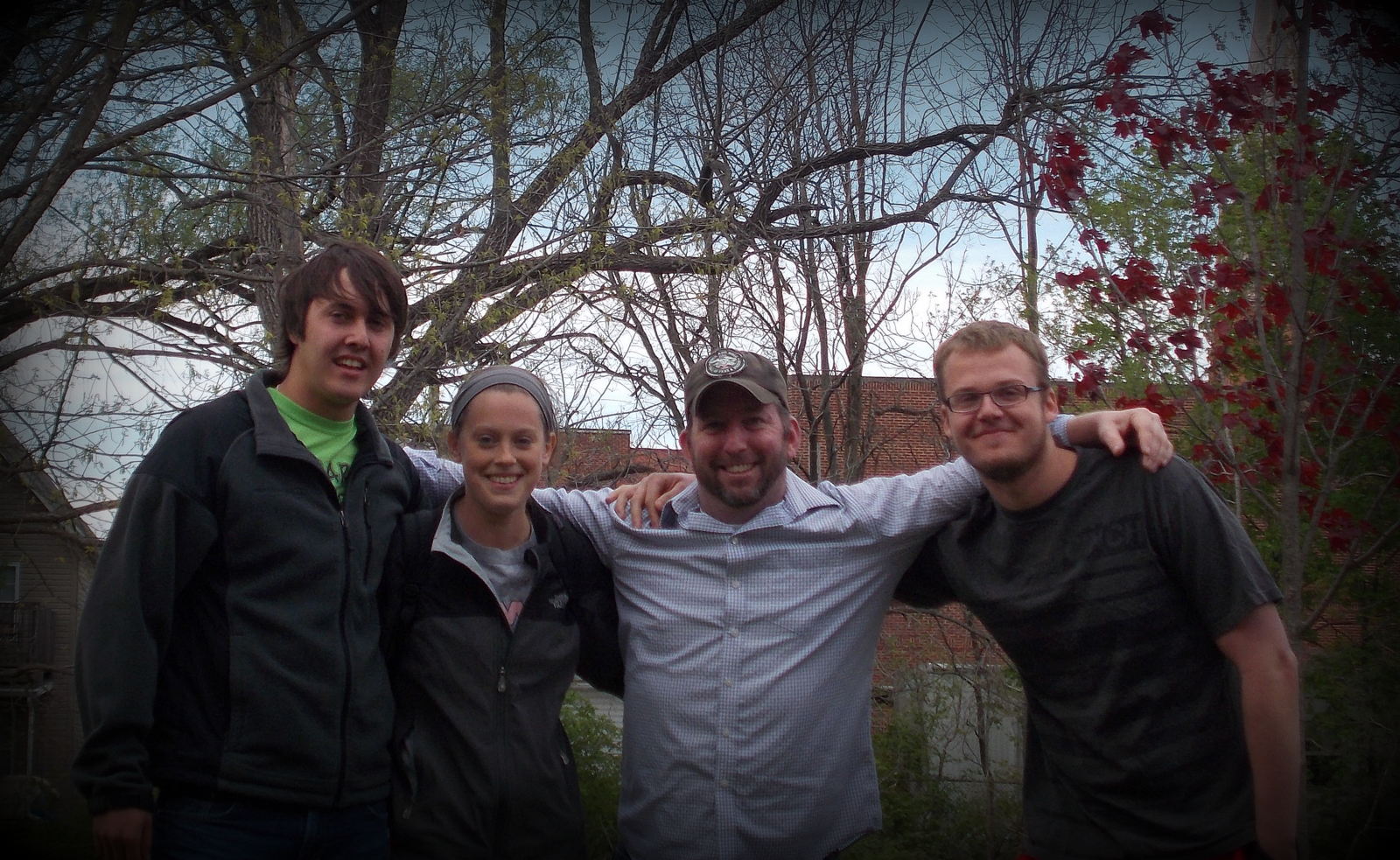
Streams to Dreams Team Spring 2014 OWU:
L-R: Zachary Siefker, Ali Smith, Max Kerns, and Wilson Taylor
Contact List:
Zachary Siefker zesiefke@owu.edu
Max Kerns mdkerns@owu.edu
Ali Smith arsmith@owu.edu
Wilson Taylor awtaylor@owu.edu