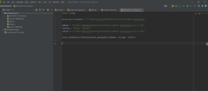
Background – For this independent study, I wanted to solve a problem that isn’t necessarily tedious but just annoying. For me, that was creating true color images through ArcPro. Working with Dr. Rowley has made me quite familiar with creating true colors, mostly creating several of them over a melt season for the Sermeq Kujalleq Ablation Region. By creating this script, it just makes everything a little easier so you don’t have to manually import which .TIFF files you want. I’ve had some experience with python before starting this course so it definitely was a little easier than I expected, and the syntax of python is just leaps and bounds ahead of that stinky language R.
Introduction – (what each step does)
- Create a geodatabase or .gdb — doing this creates a server like storage house your tiff files to make calculations and pull the data back down.
- Create Mosaic Dataset — This creates a dataset to house your images, another important step before using the composite band’s tool.
- Add rasters to Mosaic — Add your images to the dataset
- Composite Bands Tool — From the mosaic dataset, import them to the composite band’s tool, which creates the Truecolor image raster for you.


What Did I learn? —
I learned a lot from this project, firstly that ERSI software is insanely tedious when it comes to using their programs. I needed to jump through several hoops just to create a geodatabase. The geodatabase is created through ArcServer – everything must be run through the server and you need to have the software installed to even create one.
I learned to problem solve way better on my own, knowing exactly what to search to find solutions to my problem was a huge success. I genuinely didn’t have any problems with this project, nothing that was too halting that I felt like I needed to stop the project or require outside help. I dedicated about 8-10 hours a week to this project and it was mostly spent debugging and finding solutions to my code.
One issue that came across was at the very beginning of the project. To use the Arcpy library, you cannot have the newest version of python installed. The newest version is 3.10, but arcpy is currently only compatible with 3.7 and below. I felt like this project was a great introduction to the GIS developing world, and I am very glad that I took it. Overall, I am very confident in my work for this course. I believe that this script has significant use for GIS creators and researchers.
