Research on Stormwater Credits:
Delaware:
http://www.delawareohio.net/UserUploads/UserDocuments/
Departments/Public_Utilities/StormCreditManual.pdf
Ohio:
http://www.neorsd.org/I_Library.php?a=download_file&LIBRARY_RECORD_ID=4699

Storm drain decals in delaware run? – on drains above the bridge
Floodplain zones:
1. 0.2 PCT annual chance flood hazards (special flood hazard areas)
2. A: area subject to a 1% or greater annual chance of flooding any given year, with no flood elevation shown
3. AE: area subject to a 1% or greater annual chance of flooding any given year, with extensive hydraulic analysis that shows the flood elevations
4. X: areas of limited flood hazard (outside 0.2% annual chance floodplain)
Information on soil type: In order to prove we cannot build buildings on this floodplain it is important to look at what soil types exist in order to prove it is a wetland.
Sloan silt loam, 0 to 2% slopes, occasionally flooded: Very deep and poorly drained soils formed in loamy loose unconsolidated sediment. Sloan soils are most commonly on flood plains and are very poorly drained due to low permeability.Known to be artificially drained and cultivated but also known to be used as pastures or woodlands.
silt (size measurement between sand and clay whose mineral composition is quartz and feldspar. May be a soil or a suspended sediment). loam (soil composed mostly of sand and silt, with a little clay).
Scioto silt loam, 0 to 2 % slopes: contains very deep poorly drained soils and are subjected to flooding from late fall to spring. Known to be artificially drained and cultivated but also known to be used as pastures or woodlands.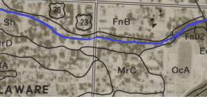
Sources:
https://soilseries.sc.egov.usda.gov/OSD_Docs/S/SLOAN.html.
https://soilseries.sc.egov.usda.gov/OSD_Docs/S/SLOAN.html

